Navigation (all brands)
Showing all 17 results
-
-
-
-
-
VFR Charts
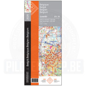
Low Air VFR Belgium (Plano- Laminated) 2026
The new 2026 version of the Belgium Low Air 1:250.000 chart, the reference for VFR flying across Belgium, contains all information relevant to VFR pilots, overlayed on the Belgian topographical chart. The airspace changes dated from March 3rd 2026, like the new Restricted Areas around the harbors of Antwerp, Ghent and Zeebrugge, EBR20 (Brasschaat) & EBR21 (North Sea), reporting point Duffy are all included…
This chart is available in 2 versions: Printed on 1 sheet, recto/verso – North and South – for easy cockpit management when flying between North and South areas; available in paper and in laminated form
It contains vital information about Belgian Airspace structure and topography:
- VFR reporting points
- Civil and Military airports with name, location identifier and frequencies, length and orientation of the runway(s), information about Direction Finding (VDF) and location of traffic pattern
- Designated airspace location, dimensions, vertical extent and airspace class.
- FIS sectors with frequencies
- Fields for hang-gliders, soaring, ULM…
- Radio Navigation beacon information (including VOR, DME, NDB, TACAN and combinations) with name, frequency and Morse code identifier
- Obstacles and elevation figures
- Isogonals
- Highways (with name), streets, railways, rivers, woods (with multi-coloring to display forest imprint and shading)
- Etc.
On the side, you can find a legend with more helpful information, like an overview of the Belgian airspace structure, ATIS and VOLMET frequencies, symbol interpretation, etc.
Specifications
- Scale: 1:250.000
- Edition: 2026
- Date of publication: May 2026( ED 35-IGNB – 2026)
- Available from 09-06-2026
SKU: VTAIR.0002.00.35-LAM -
VFR Charts
Low Air VFR Belgium (Plano) 2026
The new 2026 version of the Belgium Low Air 1:250.000 chart, the reference for VFR flying across Belgium, contains all information relevant to VFR pilots, overlayed on the Belgian topographical chart. The airspace changes dated from March 3rd 2026, like the new Restricted Areas around the harbors of Antwerp, Ghent and Zeebrugge, EBR20 (Brasschaat) & EBR21 (North Sea), reporting point Duffy are all included…
This chart is available in 2 versions: Printed on 1 sheet, recto/verso – North and South – for easy cockpit management when flying between North and South areas; available in paper and in laminated form
It contains vital information about Belgian Airspace structure and topography:
- VFR reporting points
- Civil and Military airports with name, location identifier and frequencies, length and orientation of the runway(s), information about Direction Finding (VDF) and location of traffic pattern
- Designated airspace location, dimensions, vertical extent and airspace class.
- FIS sectors with frequencies
- Fields for hang-gliders, soaring, ULM…
- Radio Navigation beacon information (including VOR, DME, NDB, TACAN and combinations) with name, frequency and Morse code identifier
- Obstacles and elevation figures
- Isogonals
- Highways (with name), streets, railways, rivers, woods (with multi-coloring to display forest imprint and shading)
- Etc.
On the side, you can find a legend with more helpful information, like an overview of the Belgian airspace structure, ATIS and VOLMET frequencies, symbol interpretation, etc.
Specifications
- Scale: 1:250.000
- Edition: 2026
- Date of publication: May 2026( ED 35-IGNB – 2026)
- Available from 09-06-2026
SKU: VTAIR.0002.00.35 -
VFR Charts
Low Air VFR Belgium (Ruffed – Laminated) 2026
The new 2026 version of the Belgium Low Air 1:250.000 chart, the reference for VFR flying across Belgium, contains all information relevant to VFR pilots, overlayed on the Belgian topographical chart. The airspace changes dated from March 3rd 2026, like the new Restricted Areas around the harbors of Antwerp, Ghent and Zeebrugge, EBR20 (Brasschaat) & EBR21 (North Sea), reporting point Duffy are all included…
This chart is available in 2 versions: Printed on 1 sheet, recto/verso – North and South – for easy cockpit management when flying between North and South areas; available in paper and in laminated form
It contains vital information about Belgian Airspace structure and topography:
- VFR reporting points
- Civil and Military airports with name, location identifier and frequencies, length and orientation of the runway(s), information about Direction Finding (VDF) and location of traffic pattern
- Designated airspace location, dimensions, vertical extent and airspace class.
- FIS sectors with frequencies
- Fields for hang-gliders, soaring, ULM…
- Radio Navigation beacon information (including VOR, DME, NDB, TACAN and combinations) with name, frequency and Morse code identifier
- Obstacles and elevation figures
- Isogonals
- Highways (with name), streets, railways, rivers, woods (with multi-coloring to display forest imprint and shading)
- Etc.
On the side, you can find a legend with more helpful information, like an overview of the Belgian airspace structure, ATIS and VOLMET frequencies, symbol interpretation, etc.
Specifications
- Scale: 1:250.000
- Edition: 2026
- Date of publication: May 2026( ED 35-IGNB – 2026)
- Available from 09-06-2026
SKU: VTAIR.0002.PP.35-LAM -
VFR Charts
Low Air VFR Belgium (Ruffed) 2026
The new 2026 version of the Belgium Low Air 1:250.000 chart, the reference for VFR flying across Belgium, contains all information relevant to VFR pilots, overlayed on the Belgian topographical chart. The airspace changes dated from March 3rd 2026, like the new Restricted Areas around the harbors of Antwerp, Ghent and Zeebrugge, EBR20 (Brasschaat) & EBR21 (North Sea), reporting point Duffy are all included…
This chart is available in 2 versions: Printed on 1 sheet, recto/verso – North and South – for easy cockpit management when flying between North and South areas; available in paper and in laminated form
It contains vital information about Belgian Airspace structure and topography:
- VFR reporting points
- Civil and Military airports with name, location identifier and frequencies, length and orientation of the runway(s), information about Direction Finding (VDF) and location of traffic pattern
- Designated airspace location, dimensions, vertical extent and airspace class.
- FIS sectors with frequencies
- Fields for hang-gliders, soaring, ULM…
- Radio Navigation beacon information (including VOR, DME, NDB, TACAN and combinations) with name, frequency and Morse code identifier
- Obstacles and elevation figures
- Isogonals
- Highways (with name), streets, railways, rivers, woods (with multi-coloring to display forest imprint and shading)
- Etc.
On the side, you can find a legend with more helpful information, like an overview of the Belgian airspace structure, ATIS and VOLMET frequencies, symbol interpretation, etc.
Specifications
- Scale: 1:250.000
- Edition: 2026
- Date of publication: May 2026( ED 35-IGNB – 2026)
- Available from 09-06-2026
SKU: VTAIR.0002.PP.35 -
Navigation Tools, Pilot Equipment, VFR Charts
Staedtler – Chinagraph Pencil
Chinagraph Pencils for marking track lines on caa and aviation laminated charts and Pilots Boards. These are water soluble pencils for all smooth surfaces.
Ideal tool for users in industry and trade For use on almost all surfaces, e.g. leather, textiles, stone, metal, wood and plastic For opaque marking even on dark and transparent surfaces No bleeding through paper Colour-intensive and light-fast Non-corrosive colour pigments No drying up Odourless
Available in 5 colours
RED / BLUE / GREEN / YELLOW / BLACK
SKU: XSP02_variaties -
Navigation Tools, Pilot Equipment, VFR Charts
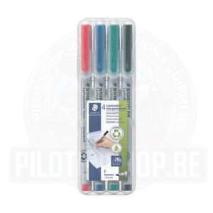
Staedtler – Lumocolor non-permanent
STAEDTLER box containing 4 Lumocolor non-permanent in RED / BLUE / GREEN / BLACK colour
Product information
- Universal pen for use on almost all surfaces
- Suitable for overhead projection
- Can be wiped off film using a damp cloth
- Water-soluble ink
- Fast-drying
- PP barrel and cap guarantee long service life
- Airplane-safe – automatic pressure equalization prevents pen from leaking on board aircraft
- High colour brilliancy
- Black is lightfast
- Line width M – medium, approx. 1.0 mm
- Refillable with refill station 487 15
- Available in stand-up STAEDTLER box
- Housing made of 97% recycled plastic
SKU: 315W-P4 -
VFR Charts
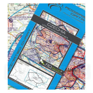
VFR Chart – Czech Republic 1:500,000 Rogers Data 2026
- Czechia VFR Aeronautical Chart – ICAO Chart 500k
Edition: 2025- Valid from 19th March 2026
- Laminated Aeronautical chart on a scale of 1:500.000
- According to ICAO Annex 4; EU-Commission Regulations; AIP
- Clear representation of the ATS airspace structure
- Reporting points, border crossing points
- Danger- and restricted areas
- Aerial sporting and recreational activities
- Areas with sensitive fauna
SKU: VFR-NL-V26-2 - Czechia VFR Aeronautical Chart – ICAO Chart 500k
-
VFR Charts
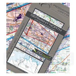
VFR Chart – Germany North 1:500,000, Rogers Data 2026
- Germany North VFR Aeronautical Chart – ICAO Chart 500k
Edition: 2026- Includes AMDT 19 MAR 2026
- Laminated aeronautical map at a scale of 1:500,000
- In accordance with ICAO Annex 4; EU regulations; AIP
- Detailed representation of the airspace structure
- Reporting points, border crossing points
- Danger and restricted airspace
- Air sports areas
- Nature reserves
SKU: VFR-NL-V26-1 - Germany North VFR Aeronautical Chart – ICAO Chart 500k
-